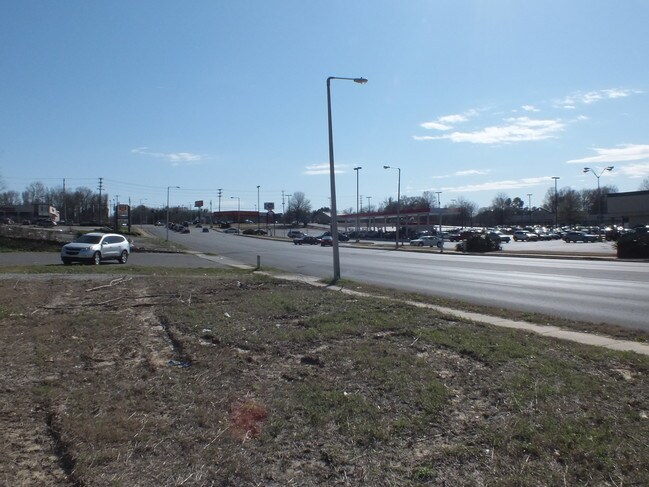
Property Record
Range Line Rd, Memphis, TN 38127


NEARBY LISTINGS FOR SALE OR LEASE
Property Detail
Range Line Rd
Memphis, TN-MS-AR
Pt Woodland Estates Sci
07-2104-0-0874C
ES RANGE LINE ROAD SEE MAP GRID 93 A
Vacantlandnec
Shelby
X
Tennessee
47157C0280F
4
2024
28.29 AC
2025
North
010121
Memphis
DEMOGRAPHICS near Range Line Rd
1 Mile
3 Mile
5 Mile
2024 Total Population
8,802
54,240
129,230
2029 Population
8,678
54,060
129,005
Pop Growth 2024-2029
(1.41%)
(0.33%)
(0.17%)
Average Age
36
35
36
2024 Total Households
3,118
19,617
47,415
HH Growth 2024-2029
(1.57%)
(0.45%)
(0.23%)
Median Household Inc
$42,830
$37,417
$37,845
Avg Household Size
2.70
2.70
2.60
2024 Avg HH Vehicles
2.00
2.00
2.00
Median Home Value
$68,039
$79,176
$88,158
Median Year Built
1967
1970
1966
Nearby Places
Map Layers
Map Styles
 Street
 Aerial
- Restaurants
- Banks
- Shops
- Fitness
- Groceries
PUBLIC TRANSPORTATION
AIRPORT
Memphis International
DRIVE
WALK
Distance
Memphis International
27 min
13.4 mi
SALE & LEASE HISTORY
LISTING DATE
SALE/LEASE

Sep 28, 2016
For Sale
Nearby Properties
Address
Land Use
TOTAL SIZE
Lot Size
Zoning
Address
Land Use
TOTAL SIZE
Lot Size
Zoning
1,709,372 SF
28.70 AC
EMP
Address
Land Use
TOTAL SIZE
Lot Size
Zoning
1,146,617 SF
62.32 AC
EMP
Address
Land Use
TOTAL SIZE
Lot Size
Zoning
917,056 SF
65.53 AC
EMP
Address
Land Use
TOTAL SIZE
Lot Size
Zoning
31,305 SF
17.89 AC
RU-3
Address
Land Use
TOTAL SIZE
Lot Size
Zoning
78,603 SF
23.30 AC
R-6
Address
Land Use
TOTAL SIZE
Lot Size
Zoning
111,016 SF
6.90 AC
CMU-1
Address
Land Use
TOTAL SIZE
Lot Size
Zoning
11,446 SF
29.76 AC
RU-3
Address
Land Use
TOTAL SIZE
Lot Size
Zoning
22,798 SF
9.63 AC
RU-3
Address
Land Use
TOTAL SIZE
Lot Size
Zoning
90,574 SF
40.74 AC
EMP
Address
Land Use
TOTAL SIZE
Lot Size
Zoning
201,722 SF
64.13 AC
EMP
Address
Land Use
TOTAL SIZE
Lot Size
Zoning
92,798 SF
12.66 AC
RU-3
Address
Land Use
TOTAL SIZE
Lot Size
Zoning
56,620 SF
25.08 AC
R-6
Address
Land Use
TOTAL SIZE
Lot Size
Zoning
32,116 SF
7.61 AC
R-6
Address
Land Use
TOTAL SIZE
Lot Size
Zoning
93,514 SF
12.47 AC
R-8
Address
Land Use
TOTAL SIZE
Lot Size
Zoning
18,492 SF
8.35 AC
R-6
Address
Land Use
TOTAL SIZE
Lot Size
Zoning
53,176 SF
12.57 AC
RU-3
Address
Land Use
TOTAL SIZE
Lot Size
Zoning
47,756 SF
9.94 AC
RU-3
Address
Land Use
TOTAL SIZE
Lot Size
Zoning
35,890 SF
10.53 AC
RU-3
Address
Land Use
TOTAL SIZE
Lot Size
Zoning
10.26 AC
R-10
Address
Land Use
TOTAL SIZE
Lot Size
Zoning
39,628 SF
8.81 AC
RU-3
Address
Land Use
TOTAL SIZE
Lot Size
Zoning
22,925 SF
13.53 AC
RU-3
Address
Land Use
TOTAL SIZE
Lot Size
Zoning
48,194 SF
5.49 AC
R-6
Address
Land Use
TOTAL SIZE
Lot Size
Zoning
122,457 SF
11.66 AC
RU-3
Address
Land Use
TOTAL SIZE
Lot Size
Zoning
51,253 SF
17.50 AC
RU-3
Address
Land Use
TOTAL SIZE
Lot Size
Zoning
236,244 SF
11.24 AC
EMP
Address
Land Use
TOTAL SIZE
Lot Size
Zoning
211,608 SF
12.23 AC
RU-3
Address
Land Use
TOTAL SIZE
Lot Size
Zoning
14,764 SF
13.18 AC
R-8
Address
Land Use
TOTAL SIZE
Lot Size
Zoning
84,851 SF
11.25 AC
CMU-2
Address
Land Use
TOTAL SIZE
Lot Size
Zoning
15,340 SF
4.07 AC
CMU-2
Address
Land Use
TOTAL SIZE
Lot Size
Zoning
26,828 SF
6.35 AC
RU-3
The World's #1 Commercial Real Estate Marketplace
Connect with us
© 2025 CoStar Group
The information above has been obtained from sources believed reliable. While we do not doubt its accuracy we have not verified it and make no guarantee, warranty or representation about it. It is your responsibility to independently confirm its accuracy and completeness. Any projections, opinions, assumptions, or estimates used are for example only and do not represent the current or future performance of the property. The value of this transaction to you depends on tax and other factors which should be evaluated by your tax, financial, and legal advisors. You and your advisors should conduct a careful, independent investigation of the property to determine to your satisfaction the suitability of the property for your needs.